One of the annual rituals at our house is applying for Western river permits every January. While there are some variables, one constant is that we always apply for the Middle Fork of The Salmon River. One of the longest un-dammed rivers in North America, running through the Frank Church River of No Return Wilderness, it is one of the most difficult permits to win. As a free flowing river, the boating season is relatively short and the competition is high. The odds of winning a permit are 1 in 25, which means you might get a permit every 25 years. We have applied 12 years in a row with no luck. However, our friend Bill Morris was lucky this year, and he invited us along on his trip.
With a put-in date of July 31, fairly late in the season, it was going to be a low water trip. This makes it easy in a kayak, but difficult in a raft. We were a group of 11 from California, Colorado and Texas, spread out into 1 oar raft, 2 catarafts, one paddle raft, an IK, and a kayak.
 |
| The put-in scene. 4-5 groups per day get to launch, so things can get a bit crowded. The rafts are lowered down the long wooden launch ramp in the background. |
|
|
|
 |
| We're off. After several hours of sorting and packing food and gear, we are finally on our way. |
The Middle Fork of the Salmon is a 100 mile, 7 day trip. As the river
flows along, more and more tributaries add water. The first 2 days were
very low flow, leaving the channel choked with boulders that had to be
negotiated with heavy rafts.
 |
| Donette and Sonya as we begin the trip. Donette and I shared rowing the 16' cataraft and paddling a kayak. Donette got the joy of rowing the first two days, as she is much more experienced at rowing. I had the job of running last in the kayak and helping anyone who got stuck get their boat off the rocks. All the boats got stuck a few times, but nothing major. Needless to say, we were all pretty tired after those two days. |
We lightened our loads as much as possible by flying most of our food and drinks in to Indian Creek, a back country ranger station and airstrip. We would pick up our food there on Day 3, after a couple of major streams had increased the main flow. Packing and organizing the food for a group this large is always a big job, and separating it between not only the rafts but the air drop as well was the quite the logistical challenge. One that we weren't quite able to live up to. At our first campsite we spent quite a while looking for the drybag that contained several of our dinners and all of the food for the first two nights. We finally came to the realization that it was not on board any of our boats. Luckily, Kim had made some extra breakfast burritos for the following morning's breakfast, so between those, a head of cabbage, and some extra lunch meat we prepared a very satisfying meal. We crossed our fingers that the missing bag was mistakenly put on the airplane, and not left in one of the vehicles. Meanwhile, there was nothing else to do but move on down the river.


 |
| The water is shallow, fast, and crystal clear. |
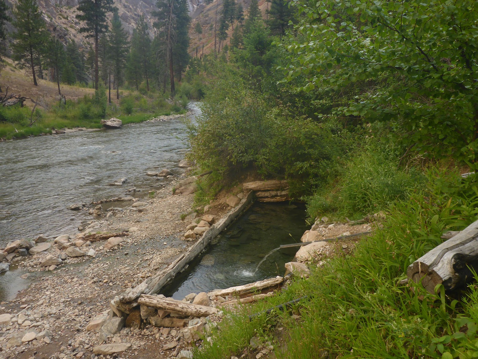
One of the attractions of the Middle Fork is the numerous hot springs along the way. Most of these we would just pull in to enjoy for a few minutes, but every group gets the option of having one night's camp near a hot springs. We chose the Loon Creek hot spring for ours It was almost a mile hike up Loon Creek to get to the pool, but it was well worth the effort.
 |
| Loon Creek hot springs shortly before being filled with naked boaters. |
|
|
 |
| This hot spring provided a river-side hot shower |
 |
| Another riverside hot spring. |
 |
| These big horn sheep wandered by on the trail next to one of the hot springs. |
 |
| Mom and baby weren't very bothered by our presence, as they walked by a few feet away. |
 |
| The young ram, however, kept stopping and giving us the eye. We backed off to the waters edge to give him all the room he wanted. |
For the most part we had sunny weather and clear skies. We got a touch of rain the second morning, and there was smoke in the air from distant wildfires most days. However, by the 4th day most of the smoke was gone
 |
| A little rain is no problem, as Barrie had a huge tarp to cover the kitchen |
 |
| One of our more picturesque camps at Dolly lake |
The Middle Fork is known for it's fishing, and Adam spent a lot of time is pursuit of trout. It is all artificial lures or flies, catch and release only. However, we were seriously considering violating that last rule if our missing food bag did not show up at the airstrip!
 |
| Fishing at camp |
 |
| Adam would often wade out into the cold water to cast. Here he finds a warmer option. |
 |
| Fish on! |
Day 3. We've survived the rocky shallows, successfully run a couple good sized rapids, enjoyed some hot springs. Now, the moment we've been waiting for. Would we find our missing food?
 |
| The beach at Indian Creek, rafts lined up for re-supply |
 |
| Yes, there it is! The missing food is found. We are saved! |
We didn't spend too much time hiking, partially because there weren't a lot of engaging hikes, and partially because we were often beat at the end of the day. We did hike a short ways to some petroglyphs, and of course to the hot springs. Another highlight was a short, steep hike to Veil Falls.
 |
| Hiking up to Veil Falls |
 |
| Looking back down on the gin clear waters |
 |
| The falls drops down from the cliff forming the outer edge of a huge cave |
 |
| At this low flow, the falls is just a thin veil of water droplets that get blown about by the breeze |
 |
| The challenge was to find a spot where the water would come by, drenching you in a chilly stream. We were fortunate to have the place to ourselves. |
 |
| Our group at the base of the falls. |
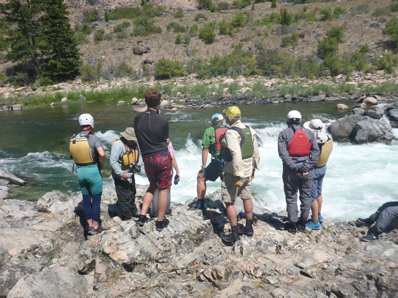
And what would a river trip be with whitewater. As the river flow increased, so did the size and intensity of the rapids. Most were just read and run on the fly, but couple were big enough to get out and scout, which has the added benefit of being able to take pictures.
 |
| Scouting Tappan Falls |
 |
| Ray running Tappan Falls in the kayak |
 |
| Captain Morris and team Perry run Tappan next |
 |
| Kim's turn in the IK |
 |
| Barrie rows his cat over the falls |
 |
| Doug and Mary after the drop |
 |
| Donette tries to dunk Sonya |
 |
| Kim approaching another narrow section |
On the last day of the trip, the Middle Fork flows into the Main Salmon. A couple more nice rapids, and you are at the take-out, an even more chaotic scene that the put in. Trucks and trailers crowd the launch ramp, boats are deflated, and everyone humps gear up to their vehicles. The river distance we floated was 100 miles, but is is a 210 mile, 6 hour drive between the put-in and take-out. We had paid to have our vehicles shuttled for us, so they were parked at the take out. We arrived fairly early in the day, and didn't have to wait long to get our turn to back down the ramp. Before long, all the boats and gear were loaded, and it was time to say goodbye. Most of the group were dispersing on their respective journeys home, but we were in no rush. We only made it a few miles down the road before we pulled over to camp, and set out all our gear to dry.
 |
| Looking back from whence we came |
 |
| Just another gorgeous free campsite in Idaho, along the banks of the Main Salmon |
 |
| Drying the gear before packing it away for the trip home |
 |
| Chairs waiting while I mix the margaritas. Life doesn't get much better than this. |
The next day, after a leisurely start, we managed to make it back to Stanley, where we started the trip. Here we said goodbye to the Perry's and tried to figure out what route we were going to take home. Our original plan was to go back through Boise and meet friends in central Oregon for some mountain biking. Weather reports and texts from friends showed it was 107* in Boise, and hot and smokey in OR. It was pleasant and smoke free here at 6,000' in the Sawtooths. We bought a local mountain biking guide map and found a nice ride a short drive away. Why leave?
 |
| Stanley Lake, base of the Sawtooths |
 |
| Midway on the Elk Mountain loop at Lake Stanley |
After a nice bike ride and a dip in Stanley Lake, we headed down the road. We decied to head home through Ketchum and do some more riding in central Idaho. We made it 30-40 miles down the road, and saw signs for the headwaters of the Salmon River. Since it was dusk, we drove up the dirt road a ways and found another wonderful camp. The next morning we explored near the headwaters. It was a several mile hike to the headwaters themselves, so we contented ourselves with wading across where it was still just a tiny stream.
 |
| Donette wades across the Salmon River near the headwaters. |
We continued on over Galena summit and found Galena Lodge on the other side. This rustic inn maintains ski and snowshoe trails in the winter, and mountain bike trails in the summer. Judging by the crowded parking lot, the riding must be good. We pulled in, looked at the trailhead map signs, talked to some local riders, and picked our rides. The trails were well made, well signed, and a blast. The lodge even had a full service bike shop, so we had lunch while Donette's bike got a little TLC. Another loop after lunch, and it was time to move on a little further down the road.
We drove to Ketchum, and after over a week in the Idaho wilderness it felt like we had entered a wormhole and emerged back home in So Cal. Range Rovers, BMW's, real estate offices, and fancy restaurants crowded the streets. We parked ourselves in a coffee shop with some cold drinks and used the wi-fi to reconnect with folks back home, as well as research local camping possibilities. One of the local bike shops gave us some great tips on some good rides, we visited a friendly bookstore, and did a litle grocery shopping. We then drove right past Sun Valley, famous playground for the rich and famous, and with 3 miles had found more awesome, free, creekside camping. The next morning we embarked on another great ride.
 |
| Riding up along the creek, cool and shady |
 |
| On the summit ridge, dry and hot and ready for a nice long downhill |
After the ride, a shower, and some lunch, it was time to get serious about heading home. Three days after getting off the river, and we had made it 80 miles toward home. Only 980 more miles to go. We decided to head straight down to Wells NV and camp at a hot spring near there.
We were driving along the Idaho plain, when suddenly, out of nowhere, we found ourselves crossing the spectacular Snake River Gorge.
 |
| Bridge over the Snake River at Twin Falls Idaho |
 |
| Looking up river |
We pulled in to the visitor center to admire the view, and found out that this bridge is the only one in the US that allows unrestricted BASE jumping. As such, it attracts BASE jumpers from around the world, and sure enough, as we were there, several groups come up throw themselves off the bridge. So we stayed and watched a few.
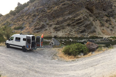
A few hours later we hit Wells, NV and found our way out to a remote hot springs nearby. The last 2 miles were rough going, with a pretty deep water crossing, but it was worth the effort.
 |
| How deep will it get? |
 |
| Spring-side camping all to ourselves |
 |
| Morning soak |
 |
| Donette riding her bike out the dirt section. She easily went twice as fast as the van could. |
We finally had to leave our private desert oasis. A long day's drive across Nevada got us to Carson City in time for a wonderful visit with our dear friends Cindy, Shane, Lynn and Tom. The next morning we got an early start and headed into the smokey Sierra Nevada for the last leg of the journey home.