When some people think of a roadside attraction, spots like this come to mind:
However, we tend to think of this. Big mountains close to the road, with a short(ish) approach and long ski descents back to the van. Birch Mountain fits the bill.
 |
|
| Birch Mountain (13,600') on the left, Mt. Tinehama on the right |
|
|
|
|
|
|
|
|
|
|
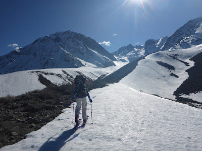
With the drought conditions for the last 5 years, we haven't really been able to enjoy one of our traditional rites of spring, the Eastside ski trip. With a near record snowpack this year, we decided we had better get over there and check it out. We left San Luis Obispo Friday morning. Our goal was to drive to Big Pine, find the road to the trail head, and ascend a ways of Birch Mountain with our overnight gear. The trailhead is about 6,400', so a 7,000' ascent to the summit seemed a bit much for a couple 50-somethings who live at sea level to accomplish in a day, so an overnighter seemed like the way to go. Along the way we were treated to magnificent vistas of snow covered peaks, with carpets of vibrant wildflowers lining the valleys along the roads.
 |
| The end of the road. |
We hit the trail about 3 PM, not sure where we were headed, but just hoping to get a few thousand feet up the mountain.
 |
| Geared up and ready to go |
 |
| So many Eastside trips start with some hiking thru the sagebrush. |
 |
| And some willow wrangling too. |
 |
| Finally on some snow! |
 |
| Great climbing conditions as we rise above the Owen's Valley |
 |
| Skinning into the setting sun, hoping to find a semi-level spot for our tent |
Around 6 o'clock we found a less steep spot at about 9,000, and decided to call it a day. We hacked out a level platform and set up the tent. Fortunately, the 40 mph winds we had fought all the way up Hwy 395 finally abated.
 |
| Sunset view from the tent. |
Saturday morning we rose before dawn, made coffee and oatmeal, and resumed our ascent. The snow was nice and firm, and the slope not too steep, so we climbed in our skis and ski crampons.
 |
| Leaving camp at sunrise |
 |
| Sunrise glow on Mt. Tinehama |
 |
| Our tent is way down by the rock bands, the van far, far below. |
 |
| The climb goes on forever, White Mountains in the background |
 |
| Add caption |
 |
| Near the top of the East Face the slope steepened considerably, so we switched to boots and crampons. The summit is still a loooong ways off. |
Donette developed some pretty painful blisters as the climb went on. We stopped a couple of times to apply moleskin and duct tape, but eventually the pain got too much. At 12,000' we had to cross a rock, snow-free area, so she decided that was high enough.
 |
| Donette airs out her painful feet |
I decided to push on in an attempt to reach the summit. It was already noon, but I thought I might be able to ascend the final snowfield in 1.5 hours. I switched back to skins and set off
 |
| Ray sets off across the final push |
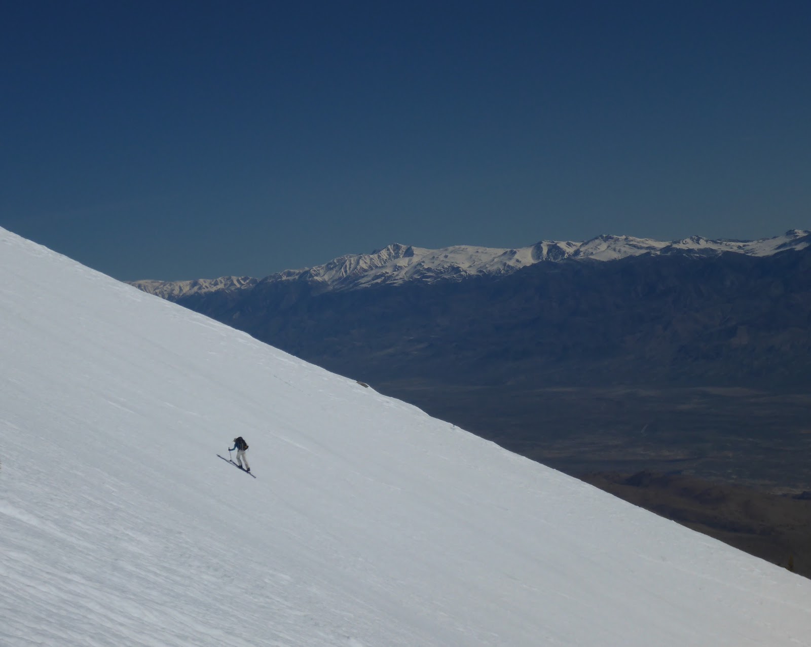
The climbing was going well for a while, but then the wind picked back up. Almost instantly the snow went from soft to frozen. I struggled on for a few more minutes, but decided it was better to turn around and enjoy some good skiing, versus struggling upward for another 1,000' of crappy skiing.
 |
| Ray just below his turnaround point, which was between the two rock bands |
Now the fun begins. The upper slopes were quite challenging, with big waves carved into the snow. I have never seen a surface quite like it, and the skiing was pretty slow at first.
After rejoining Donette, the skiing got much better. A few hundred feet more of the rough, wave ridden surface, and then it smoothed out into fantastic spring corn skiing.
 |
| Back at our tent, looking at our descent. |
Back at our campsite, we broke down the tent and loaded up our overnight gear. As we shouldered our now heavier packs, Donette says "Hey, where are my skis?"
 |
| Her skis were right next to her poles |
She had left them standing next to her poles, but now they were nowhere in sight. There were, however, a couple of tracks disappearing over the slope below camp. The skis had silently melted out, flopped over, and took off, without us ever noticing.
 |
| A couple of ski tracks disappear over the ridge |
Donette resigned herself to a bit of downhiking, and set off following the tracks. Luckily, the skis had only gone a hundred yards or so before flipping over and stopping.
 |
| Donette tracking her skis |
 |
| Yay, they are here! |
We found a much longer finger of snow to descend, compared to our ascent, and followed it until it disappeared in to the sage.
 |
| Following the white ribbon |
 |
| The snow finally peters out, and it's back to carrying the skis. |
We found an easier route through the willows, and then it was just a short hike back to the car.
 |
| An easier route thru the willows this time. |
After enjoying the luxury of a hot shower and a cold beer (or two) (we really love the van!), it was time to decide what to do next. Donette's feet were in pretty bad shape. Originally we thought we would just stay at the road's end and climb and ski on Mt. Tinehama. Donette shuddered at the thought of hiking up through the sagebrush again. We decided to try and find somewhere where we could drive closer to the snow line. Onion Valley seemed like a good choice, so with the sun setting we headed back down toward 395.
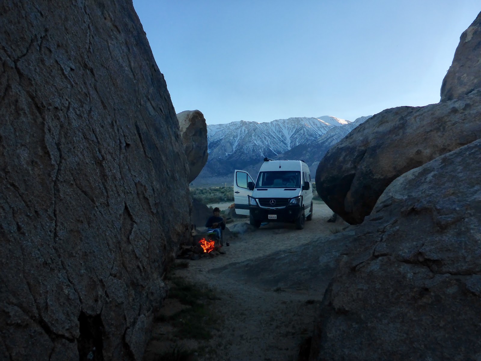
After a resupply at the market in Big Pine, and dinner at a rest stop along the highway, we finally started up Onion Valley Road in the dark. We passed a parked snowplow, and then came to the end of the plowed road, well short of Onion Valley itself. Not really knowing how far short of Onion Valley we were, we parked the van and climbed into bed.
Sunday morning we had a sincere lack of desire for another pre-dawn start. We finally rolled out of bed to find we were at about 8,000', and right below Independence Peak.
 |
| The end of the road, Independence Peak rising right behind us |
As other skiers arrived and headed up for their respective tours, we finally got around to breakfast and reorganizing our gear. The Northeast Couloir of Independence Peak, sometimes called the Banana Chute, was beckoning right behind the van. We decided it seemed like a good objective, as the base was still in the shadow and wouldn't see the softening effects of the sun for a while, and we were on a relaxed pace. We finally donned our skis and headed up about 9 am.
Within a few hundred yards we found a snow bridge across the creek, and then it was a direct ascent of the couloir, without a doubt the easiest approach ever.
 |
| The creek crossing was much easier here! |
 |
| It was basically straight up the mountain for a few hours. Ideal climbing conditions again. |
 |
| Up the chute we go. |
As we neared the top of the chute the snow conditions changed. We begin climbing into pockets of wind blown snow that hadn't had time to consolidate into corn snow. At around noon, and 11,000', the snow was getting too wet and loose for comfort, so we decided to turn around. Given the state of Donette's feet, we were very happy with getting to the point we did. Thank goodness for duct tape, and for the fact she is one tough lady!
 |
| Donette is all smiles at the thought of no more suffering up hill. |
The skiing was a little challenging in the deeper stuff at first, but got better and better as we descended.
 |
| And even more smiles on the downhill |
 |
| Spring conditions at their best |
 |
| More grins at the end of a perfect morning |
 |
| Talk about skiing right to the car! |
 |
| A good mornings work. |
Donette's feet were definitely done with ski boots for the weekend. We decided to head for Lone Pine, working our way a bit closer to home, and camp up near Tuttle Creek. We thought we might be able to hike in towards the ashram in sandals, depending in the snow line. We had an easy drive up the dirt road to the end, but when we stepped out to set up camp we were immediately swarmed by clouds of mosquitoes. Already?!? We weren't expecting that! We opted to retreat back down the mountain and camp in the Alabama Hills instead. We found a great spot right off the road, and although there were still a few bugs, it was much better.
We enjoyed a very leisurely start to our Monday morning, with a cup of coffee, then some scrambling around the rocks near camp, and finally a hearty brunch for the long drive home.